
Change Detection – Now Available on UP42
Unlocking the Power of Change Detection — Now on UP42 At Simularity, we believe in transforming satellite and aerial imagery into actionable insight. That’s why


Unlocking the Power of Change Detection — Now on UP42 At Simularity, we believe in transforming satellite and aerial imagery into actionable insight. That’s why
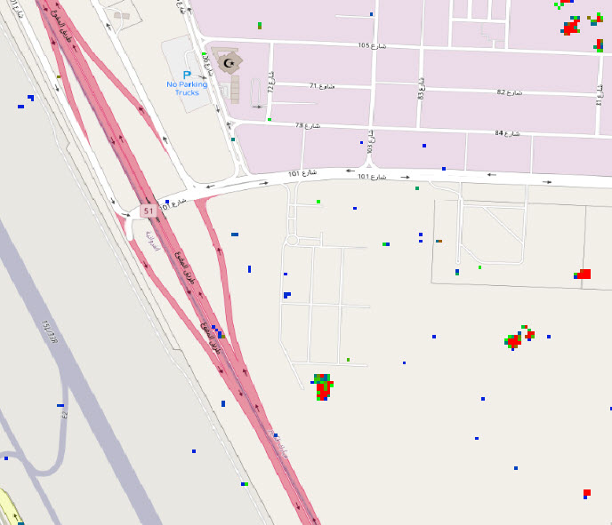
Simularity has successfully detected anomalies using SAR imagery. But first, let’s review what SAR imagery is: Synthetic Aperture Radar (SAR) is a type of radar
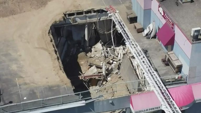
On July 14, 2022, a rooftop parking deck in Vancouver, BC collapsed, killing one person who was working in the business below. Here is the