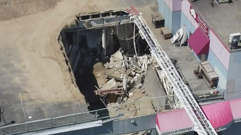
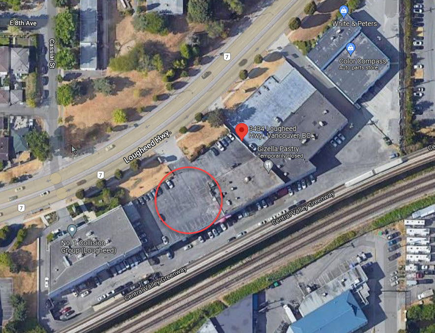
On July 14, 2022, a rooftop parking deck in Vancouver, BC collapsed, killing one person who was working in the business below.
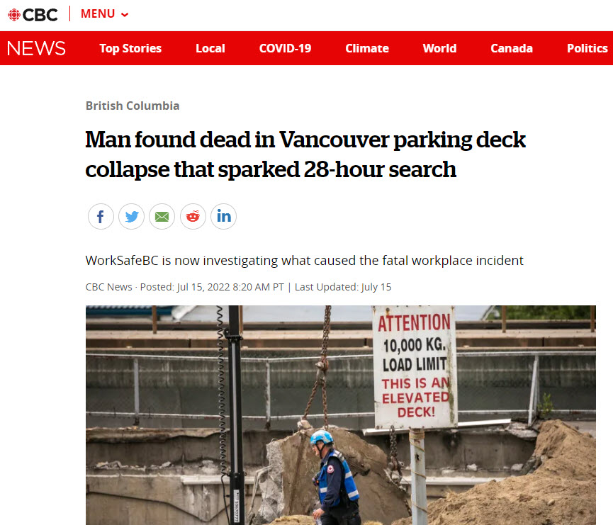
Here is the Google Map image of the location and annotated to show where the damage occured:
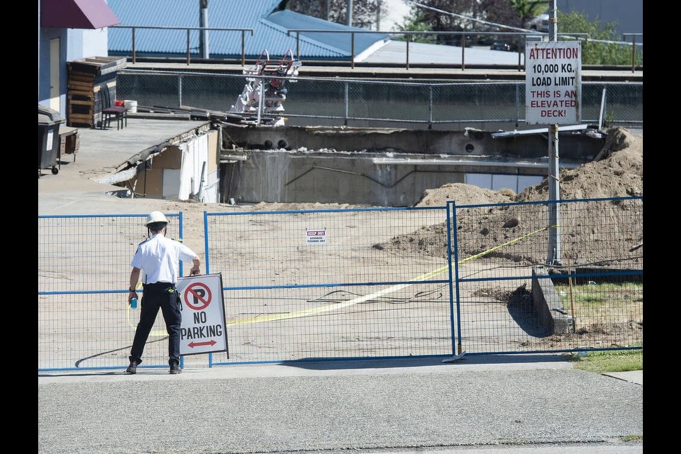
The result was a large hole in the rooftop deck and debris from the search around it.
Could such an anomaly have been detected using remote satellite imagery?
Changes to infrastructure such as buildings are often not easy to detect with optical imagery.
An alternative is SAR (Synthetic Aperture Radar) imagery, which measures differences in radar scatter caused by physical objects appearing or disappearing.
We decided to investigate if our new AIADS-SAR (Automatic Image Anomaly Detection System for SAR imagery) would be able to spot such a change.
There is very high resolution SAR imagery available for commercial and government applications. There is also the free Sentinel 1 SAR imagery which has 10m pixel resolution. Details: https://sentinels.copernicus.eu/web/sentinel/missions/sentinel-1
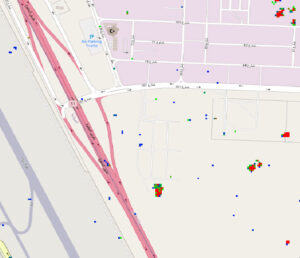
We applied our AIADS-SAR algorithm to the Sentinel 1 SAR imagery for this incident, and here is the result.
We were looking for the “hole” which appeared on the roof of the deck, and any collateral damage or debris around it.

The resulting anomaly image below shows the hole and surrounding debris.
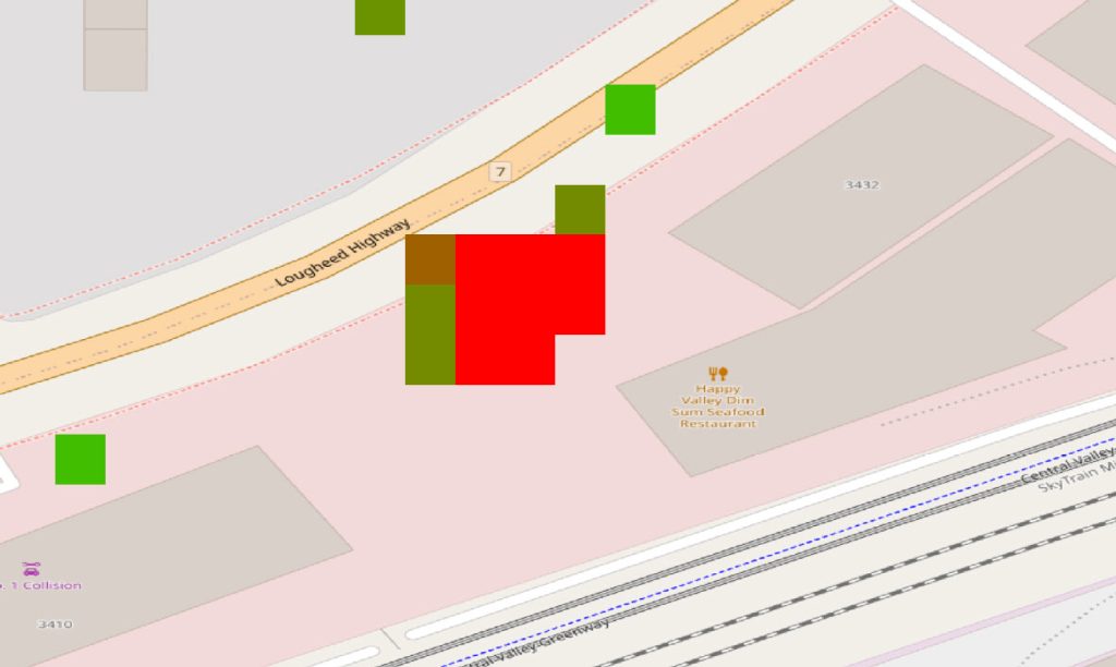
Note the anomaly is in the correct size and shape for the collapsed part of the parking deck, however it has been geospatially “moved” due to the behaviour of the light scatter signals.
This analysis shows how our AIADS-SAR module can detect a new presence or absence of material, and the general texture of that material , i.e. smooth like a parking lot, or rough, like a pile of rubble. Since SAR identifies shapes and textures, these are the types of anomalies AIADS-SAR detects. They can be man-made, or natural.
There are many useful applications of AIADS-SAR such as:
– remote construction project monitoring
– environmental changes such as drying of rivers due to Global Heating

