Introduction
The monitoring of large regions of the world for significant changes has been a challenge in the past due to insufficient imagery and timeliness of the data.
Thanks to accelerated development of satellite sensor technology and the increasing frequency of launches of cubesats, nanosats, and proliferation of UAV/Drones and even smart phones, the problem of insufficient imagery has been solved.
However, we now have an even more challenging problem: too much imagery with too high resolution being delivered at ever increasing rates.
Why is this a problem? Because there are not enough analysts in the world to examine all the imagery in a timely manner.
Tools are needed to monitor vast regions – but even small regions where significant changes can make a difference.
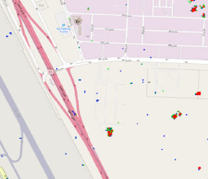
Here is a small area of interest. We want to understand what is happening on this island, and could we have detected changes in a timely manner using technology?
Image from May 2017, Source Google Earth Pro:
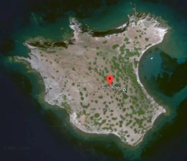
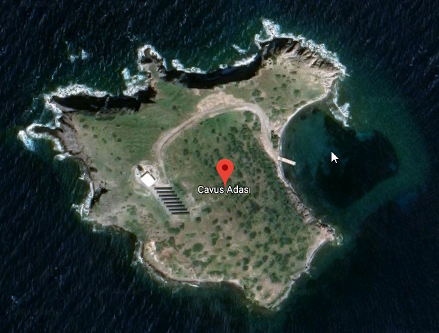
Image from April 2019, Source Google Earth Pro:
Background
Most recently the island experienced some significant construction – a solar panel facility – and we wanted to determine if temporal change detection technology could detect this activity.
A team of geospatial experts from Geospatial Enabling Technologies ( www.getmap.eu ) partnered with the US-based Geospatial AI startup, Simularity ( www.simularity.com ) to address this challenge.
Project
The input to the project was imagery from Sentinel-2, which are free with a full and open data policy.
Image Specifications
- Sentinel-2 RGB composite using the Red, Green and Blue band
- Image resolution: 10m
- Data type: Float32 (32bit floating point)
- Area tested: ~2x3km (small island, where a series of solar panels has been installed lately)
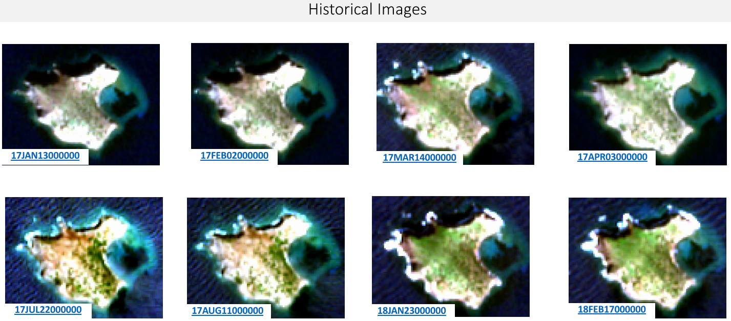
Image Input:
Historical (for model building):
- 2017-01-13
- 2017-02-02
- 2017-03-14
- 2017-04-03
- 2017-07-22
- 2017-08-11
- 2018-01-23
- 2018-02-17
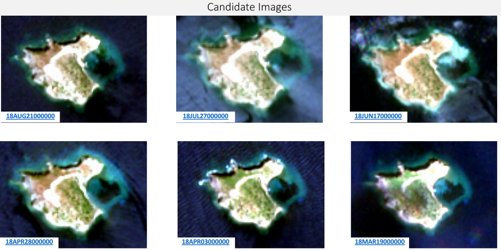
Candidate (for analysis):
- 2018-03-19
- 2018-04-03
- 2018-04-28
- 2018-06-17
- 2018-07-27
- 2018-08-21
Input image thumbnails:
Software:
Simularity Automatic Image Anomaly Detection System (AIADS v2.0)
Analysis
- Each candidate image was analyzed using the historical images as input, and with AIADS parameters varied in order to assess which parameters had the most effect on the results.
*Note that historical image 17JUL22000000 was excluded as it was not consistent with the others.
Results
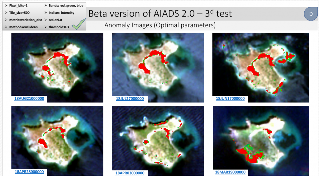
The new road and the cleared land for the panel construction was detected successfully. Some smaller anomalies – particularly at the shore of the island – were not detected. This is most likely due to higher variation in pixel values due to tidal and shadow effects at the coast/shore border.
Island studied (google maps link) is here: Cavus Adasi
Conclusions
AIADS can be applied to imagery such as Sentinel-2 to monitor continuously, in a fully automated way, areas of interest including remote islands.
There’s no need to check for data availability and proceed on processing of data because the process can be based on ready to use data through web services until new imagery is available. But even more important: there’s no need to look at imagery unless there’s something changed of interest.
Taking into consideration that you may have a new image available possibly every six days and having in mind that an automated process should run in order to detect changes in hundreds of potential “must be checked” spots, you can easily understand the importance of a tool like AIADS which can help the mission of an organization that must check on a continuous basis enormous number of spots.
Authors:
Gabriel Mavrellis, CEO, GET
Peter Koning, VP Sales, Simularity Inc.
Contact info:
For further information regarding land monitoring solutions and anomaly detection technology, please contact us below.