The challenges in using satellite and drone imagery to detect unusual changes (using historical imagery) include:
- The frequency (cadence) of the images can be too infrequent
- Dependency on daytime images relatively free of cloud cover
For more regular and consistent monitoring of areas around the world, a better solution would be to use more frequent imagery that is not “optical” in the sense that it can be affected by clouds.
Synthetic Aperature Radar imagery solves this problem and imagery is available. In fact there are now several commercial SAR image providers covering the planet on a regular basis, such as Iceye and Airbus.
While change detection is available for SAR imagery, the problem is that ALL the changes are shown. Imagine trying to monitor a very large area looking for non-standard changes – using a change detection tool is impractical. The challenge is to use stacks of historical SAR imagery to filter out the normal changes from the unusual ones – a valuable insight that has until now not been possible.
We have extended our Temporal Change algorithm called “Automatic Image Anomaly Detection System” (AIADS), to detect changes using stacks of SAR imagery.
We still have some work to do in refining our AI but are far enough to share some preliminary results. What we can now detect is “human activity”.
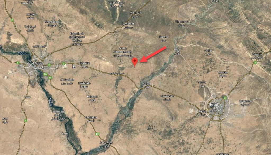
Consider the following case of a Syrian refugee displacement camp in Iraq (thanks to analysis by AllSource) where they suspect construction of an approximate 25% expansion to the camp from Oct to Nov 2019.
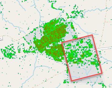
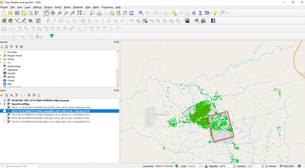
Here is the camp on Google maps, but the imagery is not up to date:
Details of the camp’s activities are in the AllSource report below:
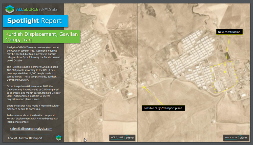
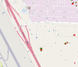
Here is an anomaly image of our new SAR/AIADS algorithm which works with Sentinel 1 AOI Clipped SAR imagery. Note how we have detected not only the activity in the existing camp but also the new construction referred to in the official report – see red boxed area below.
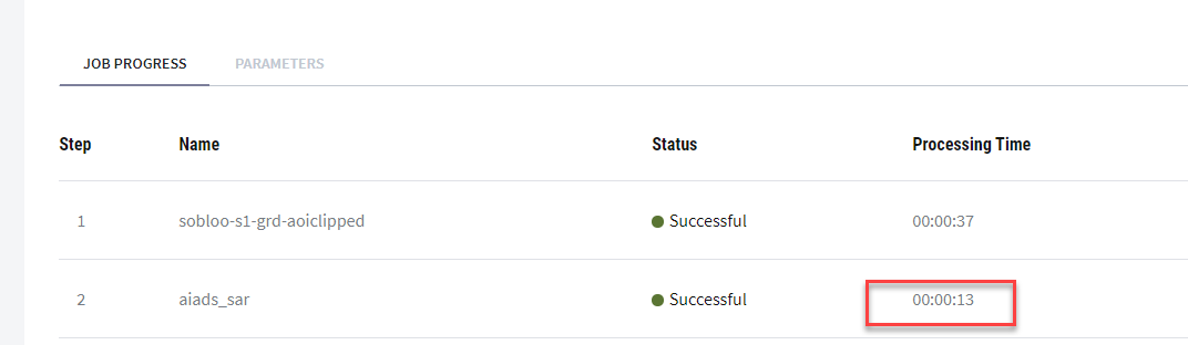
Total time to run the analysis was 50 seconds: 37 seconds to fetch the imagery and just 13 seconds to find the anomalies and output the SAR/AIADS hotspot image, on UP42.
Will this replace analysts? Definitely not. AIADS is intended to help overcome the ever increasing amount of imagery by speeding up the process of detecting unusual changes – not to interpret them or mix in other intelligence sources to create valuable insight. Tools like this are meant to help the analysts and customers quickly focus on the changes that matter.
When geospatial AI technology such as this, is paired with networks of analysts like the ones that AllSource leverages, a more finished and scalable solution is possible.
We are currently working with early adopter customers to explore this capability further, especially in areas where detection of change is needed on a frequent basis over large areas. This algorithm is currently in beta and will soon be available on up42.com
If you have any questions let us know. If you have any scenarios we can help you with, please let us know as real life customer scenarios are the most exciting.