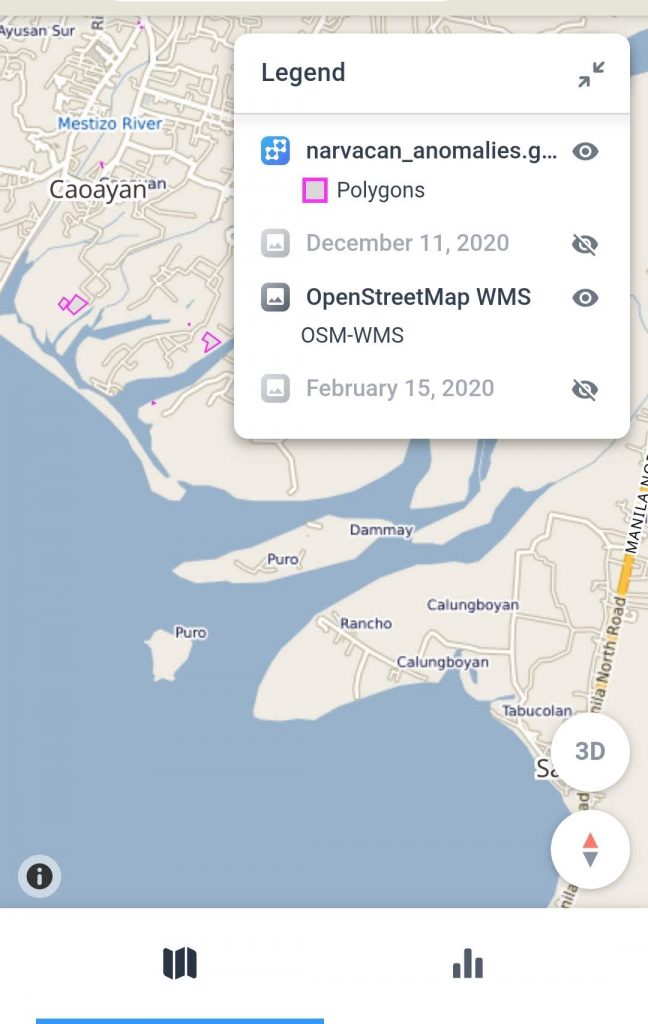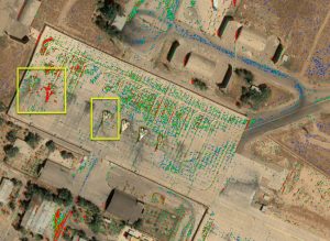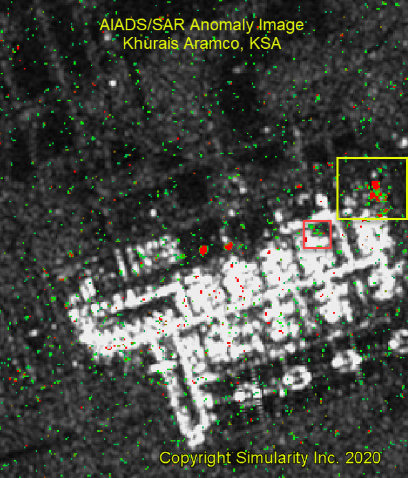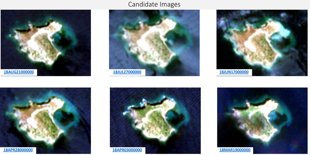
Anomaly Detection of SAR Imagery
Simularity has successfully detected anomalies using SAR imagery. But first, let’s review what SAR imagery is: Synthetic Aperture Radar (SAR) is a type of radar that uses advanced signal processing techniques to create high-resolution images of the earth’s surface from airborne or spaceborne platforms. Some of the benefits of SAR technology include: All-weather capability: SAR …