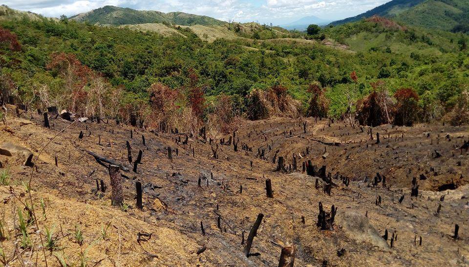
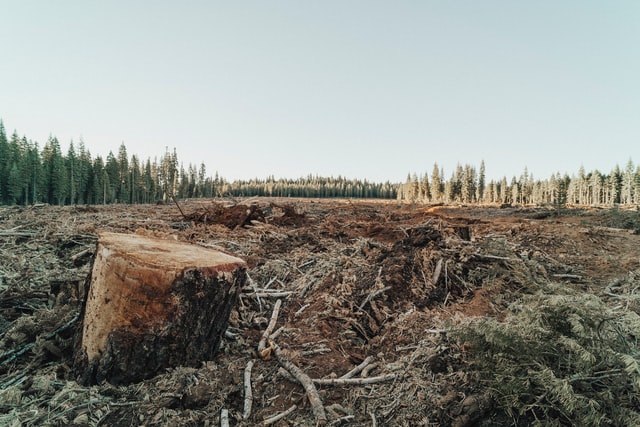
Satellite

Can AI and Satellite Imagery Detect the End of Covid-19?

Many states in the US are under “shelter in place” guidelines and as a result, most businesses are closed. The most talked about economic topic on most financial networks is will we see a V, U or L shape recovery when the shelter in place guidelines are lifted? No clear consensus has emerged yet because …

Can AI and Satellite Imagery Detect the End of Covid-19? Read More »

sar aiads anomaly image

SAR Change Detection Detects Iraqi Camp Construction in 13 Seconds

The challenges in using satellite and drone imagery to detect unusual changes (using historical imagery) include: The frequency (cadence) of the images can be too infrequent Dependency on daytime images relatively free of cloud cover For more regular and consistent monitoring of areas around the world, a better solution would be to use more frequent …

SAR Change Detection Detects Iraqi Camp Construction in 13 Seconds Read More »

Pixel-level Coregistration Algorithm Now Available

Co-Registration Now Available – At Pixel Level Change detection algorithms are quite noisy, because they detect ALL the changes between 2 images. When imagery is not aligned, the results of change detection can be much worse, and can even result in unusable output as the two input images are no longer able to relate to …

Pixel-level Coregistration Algorithm Now Available Read More »

Watershed for 18 Million People Under Attack: Using AI To Amplify Environmental Threat Detection

Almost 18 million people rely on the Angat-Umiray-Ipo Watershed, which supplies 98% of the water that goes to Metro Manila, Philippines. According to the WWF, from June to August of 2018, a series of typhoon events led to the disruption of water services and subsequent shortages throughout much of Metro Manila caused by deforestation in …

Watershed for 18 Million People Under Attack: Using AI To Amplify Environmental Threat Detection Read More »

Revealed: AI Uncovers Residential Construction Detection

A Melbourne man faced an expensive dilemma when he purchased a home that he later discovered contained illegal additions. This sad but fascinating story was published in the ABC’s News in September 2018, as the screenshot from the story shows below. Illegal construction is a massive and expensive problem worldwide. At Simularity, we were curious …

Revealed: AI Uncovers Residential Construction Detection Read More »

Simularity Arrives in Berlin as Partner for UP42 Launch

On May 6, 2019 we attended the launch event for UP42, an exciting new startup that promises to enable more users to take advantage of the growing base of imagery and image processing algorithms – all together on one easy to use platform. Our VP of Sales, Peter Koning, attended the event and presented some …

Simularity Arrives in Berlin as Partner for UP42 Launch Read More »

Using AI+SAR+Optical To Find The Invisible

Shining A Light On Illicit Activities Trying to hide your illicit activities by doing them at night? Not any more – AI+SAR+Optical  can be trained to track activity at night. Trying to hide your illicit activities under the canopy of trees?  Not any more. AI+SAR+Optical can be trained to see the texture and health of …

Using AI+SAR+Optical To Find The Invisible Read More »

Satellite Image Analysis Is Expanding: 3 Indicators

Analysis of satellite images is nothing new. Governments have used it to monitor other countries for decades. Hedge funds started to innovate by using satellite imagery to count cars in company parking lots to predict sales 15 years ago. But until recently, from a technology perspective, limited imagery, and the highly manual process of image …

Satellite Image Analysis Is Expanding: 3 Indicators Read More »

Military Facilities On Mischief Reef

It’s no secret that China is building massive military facilities on former reefs known as the Spratly Islands. But what exactly are they doing, and at what pace? Using Simularity’s Automatic Image Anomaly Detection System (AIADS), we can analyze a candidate image against a set of historical images, as the AI can learn from the …

Military Facilities On Mischief Reef Read More »